CommandX - Droniq Air Situation Interface, 5 units - Annual subscription
Safe operations through transparent, real-time airspace monitoring.
From €3.500,00excl. VATFrom €4.165,00incl. VAT
License for 5 units, including all users
Real-time air situation directly in the CommandX platform
Automatic Real-Time Transmission of Aviation Data
A Unified Overview for Multiple Locations or Organizational Units
Greater Safety During Operations Involving Drones and Aircraft
The CommandX Droniq Integration for 5 units enhances the proven CommandX command and operations management platform with up-to-date, real-time air traffic information. Operations centers, control centers, and first responders receive a comprehensive situational overview that displays the movements of rescue helicopters, airplanes, and drones directly on the operational map.
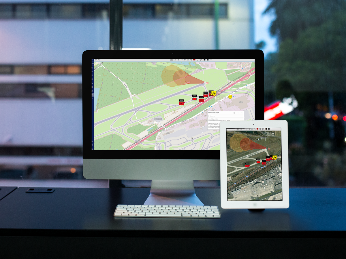
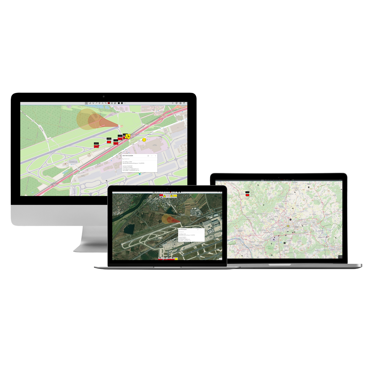
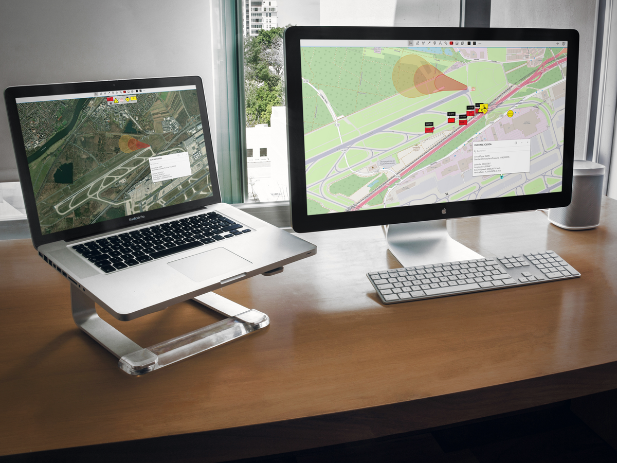
Through the automated transmission of Droniq air situation data, relevant information such as the position, altitude, speed, and identification of aircraft is immediately integrated into CommandX. The real-time data is available as a separate map layer and can be flexibly incorporated into situational awareness and incident coordination.
The license covers 5 units, allowing all authorized users within these units to access the same air situation information. This creates a unified, cross-organizational situational picture that significantly simplifies collaboration between incident commanders, control centers, and operational response teams.
This integration supports safe and efficient incident command, particularly during large-scale emergencies, law enforcement and public safety operations, disaster response efforts, or operations involving drones and rescue helicopters. Risks can be identified early, air and ground operations can be better coordinated, and decisions can be made based on up-to-date, real-time information.
CommandX from EuroCommand is a professional command and operations management platform for government agencies and organizations responsible for security. The solution supports real-time operational planning, situational awareness, and coordination, and provides the foundation for rapid and informed decision-making. By integrating the Droniq air situation picture, the situational awareness is enhanced with up-to-date information from the airspace.
EuroCommand Platform
What is CommandX?
CommandX from EuroCommand is a professional command and operations management platform for government agencies and organizations responsible for security. The solution supports real-time operational planning, situational awareness, and coordination, and provides the foundation for rapid and informed decision-making. By integrating the Droniq air situation picture, the situational awareness is enhanced with up-to-date information from the airspace.
Overview of the Situation
Overview of the Situation
All information. One platform. One situational overview.
CommandX consolidates operational information, mission data, and external data sources into a single, centralized view. This provides leaders with a complete overview of mission operations at all times and lays the foundation for efficient coordination among all parties involved.
Real-Time Leadership
Real-Time Leadership
Act, Don't Just React
With up-to-date, real-time information, CommandX supports quick and well-informed decisions. Developments in the operational area become immediately visible and can be directly incorporated into situational assessment and mission planning.
Flexibly expandable
Flexibly expandable
As requirements grow
CommandX can be continuously expanded thanks to its open integration capabilities. New features and data sources, such as the Droniq air situation picture, can be seamlessly integrated to enhance the situational awareness exactly where additional information is needed.
CommandX
IN THE FIELD
The CommandX command and control platform was developed specifically for organizations that need to maintain a constant overview of their operational area. Particularly during operations involving drones, rescue helicopters, or other aircraft, this integration enables safe coordination among all parties involved and improves real-time situational assessment. This allows all users involved to access the same information and act based on a shared situational picture.
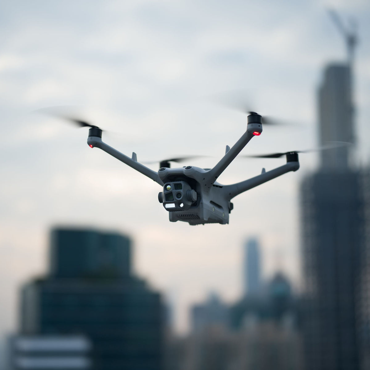
The CommandX Droniq integration provides up-to-date air traffic information directly within the operations platform. Operations managers can monitor air traffic in real time and obtain a comprehensive situational picture of drones, rescue helicopters, and other aircraft in the relevant operational area.
Up-to-date information with no extra effort
Automated Data Transfer
Air traffic data is transmitted automatically via the integrated Droniq agent. Relevant information is immediately available in CommandX, eliminating the need for emergency responders to manually enter data or switch between different systems. This saves time and reduces potential sources of error during operations.
Visualize air traffic directly on the mission map
Interactive Air Situation Map
All tracked aircraft are displayed as a separate layer on the digital map. In addition, key information such as position, altitude, speed, and climb and descent rates is available. The display can be flexibly shown or hidden, ensuring maximum transparency in the operational area.
Thorough Situation Assessment for Complex Operational Scenarios
Safe Operational Decisions
By combining ground-based command information with real-time data from the airspace, an enhanced situational picture is created for the incident command. Risks can be identified early on, air and ground operations can be better coordinated, and decisions can be made more quickly and with greater confidence. This provides a decisive information advantage, particularly during operations involving drones or rescue helicopters.
Keep track of airspace at all times
Real-Time Live Air Situation
The CommandX Droniq integration provides up-to-date air traffic information directly within the operations platform. Operations managers can monitor air traffic in real time and obtain a comprehensive situational picture of drones, rescue helicopters, and other aircraft in the relevant operational area.
Up-to-date information with no extra effort
Automated Data Transfer
Air traffic data is transmitted automatically via the integrated Droniq agent. Relevant information is immediately available in CommandX, eliminating the need for emergency responders to manually enter data or switch between different systems. This saves time and reduces potential sources of error during operations.
Visualize air traffic directly on the mission map
Interactive Air Situation Map
All tracked aircraft are displayed as a separate layer on the digital map. In addition, key information such as position, altitude, speed, and climb and descent rates is available. The display can be flexibly shown or hidden, ensuring maximum transparency in the operational area.
Thorough Situation Assessment for Complex Operational Scenarios
Safe Operational Decisions
By combining ground-based command information with real-time data from the airspace, an enhanced situational picture is created for the incident command. Risks can be identified early on, air and ground operations can be better coordinated, and decisions can be made more quickly and with greater confidence. This provides a decisive information advantage, particularly during operations involving drones or rescue helicopters.
Real-Time Air Situation
Central Operations Command
Shared Situation Assessment
Warning Systems
System Requirements & Package Contents
System Requirements
The Droniq integration into CommandX is fully integrated into Eurocommand GmbH’s system architecture and can be activated without any additional installation effort. It enhances the command and control system by providing a real-time display of air traffic directly on the situational map and enables the precise integration of air movements into mission coordination.
The following requirements must be met for operation:
Software requirements: Latest version of CommandX
Module requirement: active CIMgate.Connect module with Droniq agent
Network connection: stable Internet connection for continuous retrieval of Droniq live data
Access requirements: Valid Droniq account or authorization to use Droniq data services
Server environment: Windows-based server environment in accordance with CommandX system requirements
Licensing: Activation of the Droniq integration is performed automatically by Eurocommand; the purchase and activation of Droniq data services are handled through Droniq
What's Included
The Droniq air situation interface is supplied for Eurocommand's CommandX software.
In addition to the setup fee of 3,500 EUR (net), an annual subscription is required, which is billed in advance either quarterly (300 € net) or annually (1,000 € net).
Billing begins on the 1st of the following month and is based on an invoice. You are purchasing a license for 5 units, which means that all users can access the units. The setup fee is due immediately upon placing the order.
The access token for the software is sent to the user digitally.
Note: The CommandX software is not included. This is only the interface to CommandX.
Frequently Asked Questions
Who is the CommandX Droniq Integration for 5 units suitable for?
The solution is designed for government agencies, law enforcement and emergency response organizations, control centers, incident command centers, and operators of critical infrastructure who wish to provide multiple organizational units with a shared, up-to-date situational overview.
How many users is the license valid for?
The license covers 5 units. All users within these units can access the integrated Droniq air situation in CommandX and use the information provided for planning, situational awareness, and mission coordination.
What information is displayed in CommandX?
The integration provides real-time air traffic information. This includes, among other things, the position, identification, altitude, speed, and climb and descent rates of tracked aircraft within the defined operational area.
Does air traffic data have to be transferred manually?
No. Data is transmitted automatically via the integrated Droniq agent. Air situation information is made available directly in CommandX and is accessible to users without any additional effort.
What added value does integration offer for incident command?
Combining command and control information with real-time data from the airspace provides an enhanced situational picture. Risks can be identified early, air and ground operations can be better coordinated, and decisions can be made more quickly and with greater confidence. This is particularly advantageous during operations involving drones, rescue helicopters, or other aircraft.
Choosing a selection results in a full page refresh.