Plan, fly, and document drone missions professionally with a single solution—available as both an app and a web app.
€5,03excl. VAT€5,99incl. VAT€5,03
Can be canceled monthly and used flexibly
Validate flight destinations in seconds
Use Real-Time Live Air Situation Data
Receive warnings early
Digitally Document Flights
Available as an app and a web app
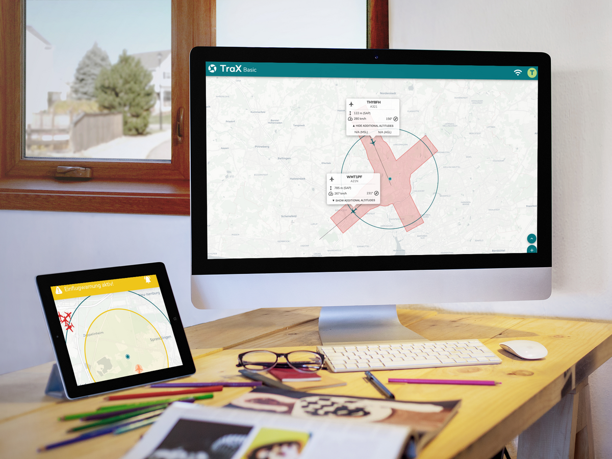
TraX Plus is the digital solution for safe, structured, and traceable drone operations. The application combines flight validation, geofence and weather information, live air situation, alerts, a flight log, and a mission center in a single app and web app. Relevant air traffic data from RADAR, ADS-B, and FLARM support better situational awareness before and during flight. The active flight area can be visualized to provide greater transparency in airspace. TraX Plus is suitable for recreational pilots, commercial users, businesses, and first responders who want to efficiently plan, safely execute, and comprehensively document drone flights. Thanks to a monthly subscription, you remain flexible and can take advantage of the platform’s extensive features at any time.
TraX is the central platform for planning, executing, and documenting drone missions. Available as both an app and a web app, this solution brings together all the relevant information needed for safe and efficient flight operations in a single application. From mission preparation to real-time air situation awareness to documentation, TraX supports drone pilots throughout the entire flight operation.
Platform
What is TraX?
TraX is the central platform for planning, executing, and documenting drone missions. Available as both an app and a web app, this solution brings together all the relevant information needed for safe and efficient flight operations in a single application. From mission preparation to real-time air situation awareness to documentation, TraX supports drone pilots throughout the entire flight operation.
A Platform for Drone Operations
A Platform for Drone Operations
TraX combines the planning, execution, and documentation of drone missions in a single, centralized application. All relevant information and tools are available in one place, helping remote pilots prepare missions efficiently, carry them out safely, and follow up professionally. Available as both an app and a web app, TraX guides you from the initial mission concept through to the completed mission.
Greater Transparency in Airspace
Greater Transparency in Airspace
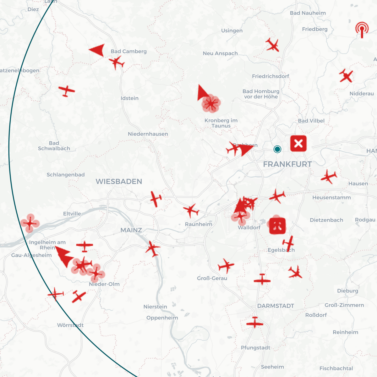
By integrating various air traffic and flight data, TraX provides a comprehensive overview of low-altitude airspace. Pilots receive the information they need to make informed decisions and carry out their missions with greater situational awareness.
Flexible in the office and on the job
Flexible in the office and on the job
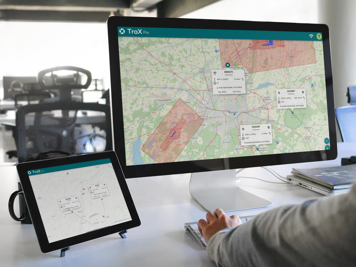
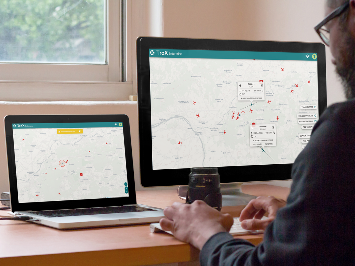
Whether at a desk planning operations or out in the field: TraX is available as a mobile app and a web app. With a single user account, users can access their data, missions, and information across all platforms.
TRAX Plus
IN THE FIELD
Recreational pilots want to fly safely. Businesses need efficient processes. Government agencies and emergency response organizations rely on reliable information. TraX brings together the right information for a wide variety of operational scenarios and helps users carry out their drone missions safely, professionally, and successfully.
Check planned drone missions for geozones, airspace restrictions, and other relevant conditions. Combined with up-to-date weather information, TraX helps you make safe and informed go/no-go decisions even before takeoff.
In Action
Keep track of manned and unmanned air traffic at all times. Live air situation updates, real-time information, and intelligent alerts help you detect changes in airspace early on and make the right decisions during the mission.
Documentation & Tracking
Plan, document, and manage your drone operations centrally in TraX Plus. The flight log, mission center, map views, geofence layers, and measurement and analysis tools help you prepare for and follow up on your missions. Use TraX flexibly as a mobile app or conveniently via the web app on your desktop.
Flight Planning
Check planned drone missions for geozones, airspace restrictions, and other relevant conditions. Combined with up-to-date weather information, TraX helps you make safe and informed go/no-go decisions even before takeoff.
In Action
Keep track of manned and unmanned air traffic at all times. Live air situation updates, real-time information, and intelligent alerts help you detect changes in airspace early on and make the right decisions during the mission.
Documentation & Tracking
Plan, document, and manage your drone operations centrally in TraX Plus. The flight log, mission center, map views, geofence layers, and measurement and analysis tools help you prepare for and follow up on your missions. Use TraX flexibly as a mobile app or conveniently via the web app on your desktop.
TraX can be used via a web browser on modern PCs, laptops, smartphones, and tablets. For the web app, we recommend using a modern browser such as Chrome, Firefox, Edge, or Safari, as well as a stable internet connection. For mobile use via the TraX app, please refer to the current system requirements and compatibility information listed in the Google Play Store and Apple App Store.
What's Included
Digital access to TraX Plus based on your selected subscription
Available as an app and a web app
Single-user license for 1 user / max. 1 order per customer
Access to features such as flight validation, real-time air traffic, alerts, weather information, and flight log
User manual / login access to the platform
Frequently Asked Questions
Who is TraX Plus designed for?
TraX Plus is designed for recreational pilots, commercial drone users, businesses, and law enforcement and emergency response organizations that want to professionally plan and document drone operations.
What are the advantages of the live aerial view?
The live air traffic display shows relevant air traffic data from RADAR, ADS-B, and FLARM. This allows you to better assess the situation in the airspace and make informed decisions.
Can I make my flight path visible?
Yes. The “Fly Now” feature allows you to view the active flight zone and provides greater transparency in the airspace.
Is TraX Plus available as an app and a web app?
Yes. TraX Plus can be used both on mobile devices via the app and in a browser via the web app.
How flexible is the monthly subscription?
The TraX Plus monthly subscription offers flexible monthly usage and can be tailored to your current needs.
Choosing a selection results in a full page refresh.