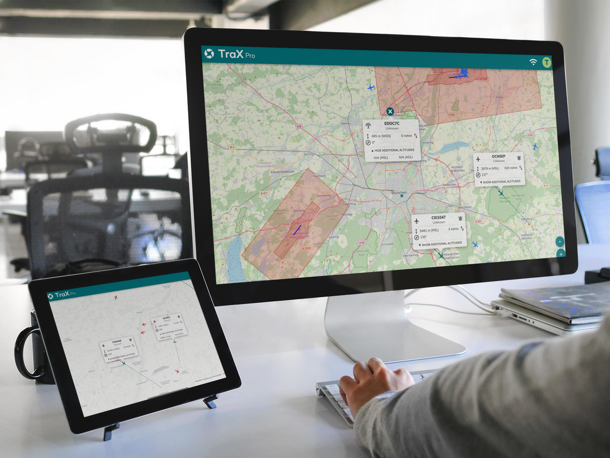
For demanding drone missions with advanced situational awareness and planning capabilities.
€50,41excl. VAT€59,99incl. VAT€50,41
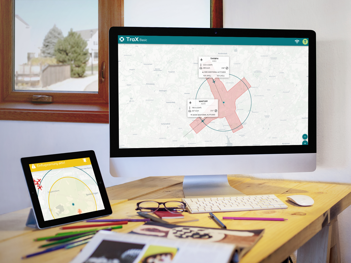
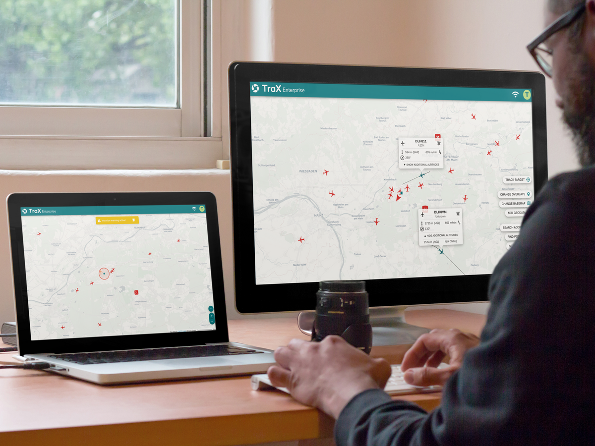
Expanded live air situation coverage up to a 60-km radius
RADAR, ADS-B, and FLARM Integration
Collision Warnings and Target Tracking
Importing Your Own Operational Data via KML
Map, Geozone, and Real-Time Overlays
Professional Mission Center
Suitable for BVLOS and SORA scenarios
Available as an app and a web app
TraX Pro was developed specifically for professional drone pilots, businesses, and first responders. The platform expands on the proven features of TraX Plus with professional tools designed for complex operational scenarios, larger operational areas, and heightened safety requirements.
With enhanced live situational awareness, intelligent alert mechanisms, KML import, and powerful overlays, TraX Pro supports professional mission planning and the execution of demanding missions. The combination of real-time information, flight validation, and documentation ensures greater transparency, safety, and efficiency throughout the entire mission.
Operators with BVLOS, SORA, or TMPR-related requirements, in particular, benefit from the advanced features for situational awareness and risk mitigation.
TraX is the central platform for planning, executing, and documenting drone missions. Available as both an app and a web app, this solution brings together all the relevant information needed for safe and efficient flight operations in a single application. From mission preparation to real-time air situation awareness to documentation, TraX supports drone pilots throughout the entire flight operation.
Platform
What is TraX?
TraX is the central platform for planning, executing, and documenting drone missions. Available as both an app and a web app, this solution brings together all the relevant information needed for safe and efficient flight operations in a single application. From mission preparation to real-time air situation awareness to documentation, TraX supports drone pilots throughout the entire flight operation.
A Platform for Drone Operations
A Platform for Drone Operations
TraX combines the planning, execution, and documentation of drone missions in a single, centralized application. All relevant information and tools are available in one place, helping remote pilots prepare missions efficiently, carry them out safely, and follow up professionally. Available as both an app and a web app, TraX guides you from the initial mission concept through to the completed mission.
Greater Transparency in Airspace
Greater Transparency in Airspace
By integrating various air traffic and flight data, TraX provides a comprehensive overview of low-altitude airspace. Pilots receive the information they need to make informed decisions and carry out their missions with greater situational awareness.
Flexible in the office and on the job
Flexible in the office and on the job
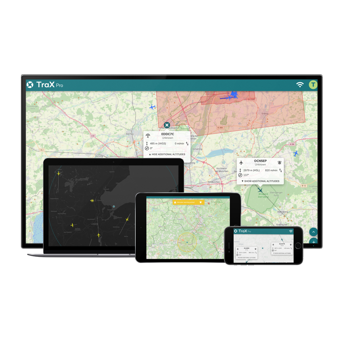
Whether at a desk planning operations or out in the field: TraX is available as a mobile app and a web app. With a single user account, users can access their data, missions, and information across all platforms.
TraX Pro
IN THE FIELD
TraX Pro was developed for professional drone missions. The platform supports businesses, first responders, and specialized service providers in complex operations by providing advanced situational awareness, professional planning tools, and BVLOS support.
Plan complex drone missions with advanced mapping, geofencing, and planning features. Weather information, flight validation, and the integration of your own KML data ensure maximum transparency right from the planning stage.
Enhanced Live Air Situation
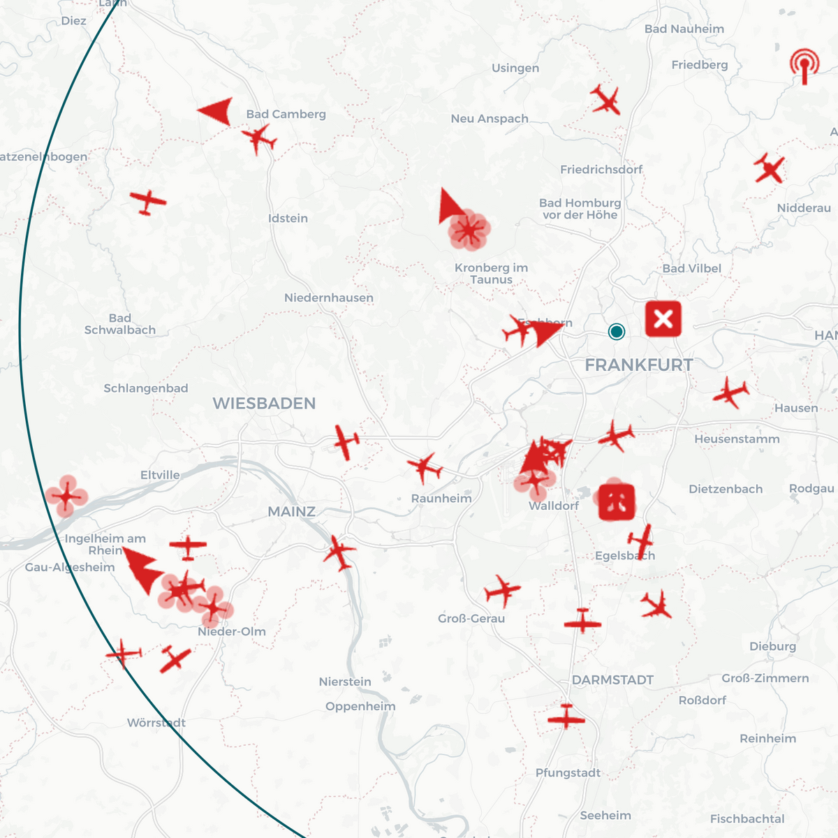
Take advantage of an enhanced real-time air situation display featuring RADAR, ADS-B, and FLARM data, as well as a wider surveillance area. This allows professional users to maintain a clear overview at all times, even in challenging operational scenarios.
BVLOS Support & Warning Systems
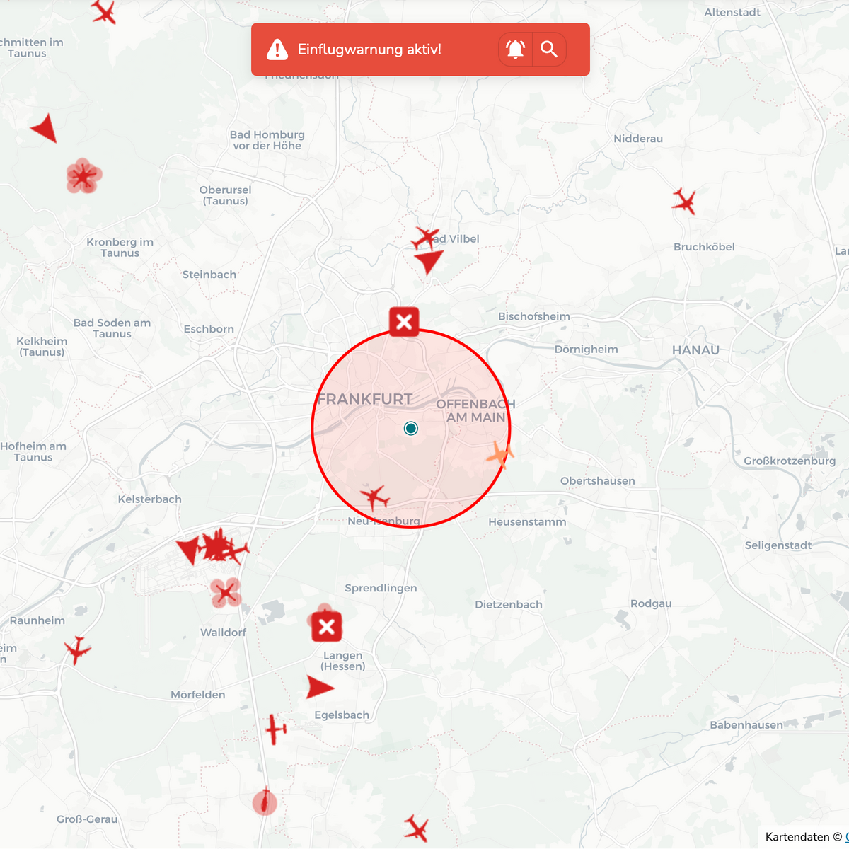
Collision warnings, target tracking, and intelligent alert functions support drone operations with heightened safety requirements. Ideal for professional applications where situational awareness and risk minimization are critical.
Professional Resource Planning
Plan complex drone missions with advanced mapping, geofencing, and planning features. Weather information, flight validation, and the integration of your own KML data ensure maximum transparency right from the planning stage.
Enhanced Live Air Situation
Take advantage of an enhanced real-time air situation display featuring RADAR, ADS-B, and FLARM data, as well as a wider surveillance area. This allows professional users to maintain a clear overview at all times, even in challenging operational scenarios.
BVLOS Support & Warning Systems
Collision warnings, target tracking, and intelligent alert functions support drone operations with heightened safety requirements. Ideal for professional applications where situational awareness and risk minimization are critical.
TraX can be used via a web browser on modern PCs, laptops, smartphones, and tablets. For the web app, we recommend using a modern browser such as Chrome, Firefox, Edge, or Safari, as well as a stable internet connection. For mobile use via the TraX app, please refer to the current system requirements and compatibility information listed in the Google Play Store and Apple App Store.
What's Included
Digital access to TraX Pro based on your selected subscription
Available as an app and web app
Single-user license for 1 user / max. 1 order per customer
Access to features such as flight validation, live air traffic, alerts, weather information, and flight log
User manual / Login access to the platform
Frequently Asked Questions
What is the difference between TraX Pro and TraX Plus?
TraX Pro offers additional features for professional use, including an enhanced live air traffic view, approach warnings, KML import, overlays, and specialized tools for complex operational scenarios.
For which users was TraX Pro developed?
TraX Pro is suitable for businesses, law enforcement and emergency response organizations, surveying firms, infrastructure operators, energy providers, and professional drone pilots.
Can I integrate my own application areas and planning data?
Yes. Using the KML import feature, you can integrate your own service areas, routes, and other planning data directly into the platform.
Does TraX Pro support BVLOS operations?
TraX Pro supports professional users with advanced location information, alert functions, and tools for demanding operations beyond direct line of sight.
What aviation data is displayed?
The platform combines relevant data sources such as RADAR, ADS-B, and FLARM and displays them in an enhanced live air situation map.
Choosing a selection results in a full page refresh.